Master PBN: Your Essential Guide to Performance-Based Navigation for the EASA IR
So, you're starting your EASA Instrument Rating (IR) training? Congratulations! You're stepping into a world of precision, procedures, and the exciting capabilities of modern aviation. A cornerstone of that modern world is Performance-Based Navigation (PBN). If terms like RNAV, RNP, LPV, and LNAV/VNAV seem like a new language, don't worry. This guide is designed for student pilots like you, aiming to demystify PBN and show you why it's crucial for your IR and future flying career.
As an IR student, PBN isn't just an add-on; it's a fundamental part of your training and the future of how we navigate the skies. EASA has made it clear: PBN is integral, and by June 1, 2030, virtually all instrument approaches and Standard Instrument Departures (SIDs) will be PBN-based. So, let's get you ahead of the curve!
What Exactly is Performance-Based Navigation (PBN)? The Lowdown for Student Pilots
At its core, PBN represents a shift from conventional, ground-based navigation (relying solely on VORs, NDBs, and ILS) to a system where aircraft navigate with greater precision using on-board performance monitoring and alerting capabilities. Instead of being constrained to fly to and from ground stations, PBN allows aircraft to fly more direct routes, efficiently and safely, within a defined airspace.
Think of it like this:
- Conventional Navigation: Like following a specific set of roads (airways) defined by the location of signposts (ground-based navaids).
- PBN: Like using a highly accurate GPS in your car that knows the road network but can also create the most efficient path, even if it means "cutting corners" safely and with precision, all while constantly checking that it's capable of following that path accurately.
Two key terms form the foundation of PBN:
- Area Navigation (RNAV): This is the basic capability of navigating along any desired flight path, rather than being restricted to routes defined by ground-based navaids. RNAV systems can use inputs from various sources like GPS (GNSS), INS, or DME/DME.
- Required Navigation Performance (RNP): This is a more advanced form of RNAV. The crucial difference is that RNP systems include on-board performance monitoring and alerting. This means the system constantly checks if it's meeting the required navigation accuracy for a specific airspace or procedure. If it's not, it alerts the crew. This alerting function is a major safety enhancement.
Benefits of PBN:
- Increased Airspace Capacity and Efficiency: More direct routes and optimized track spacing.
- Reduced Flight Times and Fuel Burn: Shorter routes mean less fuel and time.
- Improved Safety: Precise track keeping and, with RNP, on-board monitoring and alerting.
- Better Airport Access: PBN enables approaches to runways not equipped with traditional ILS, especially in challenging terrain.
- Environmental Benefits: Optimized routes and descents can lead to reduced emissions and noise.
PBN in Your EASA IR Training: What EASA Expects
Performance-Based Navigation is a mandatory part of your EASA Instrument Rating. To have PBN privileges endorsed on your license, EASA regulations (like Part-FCL, specifically referencing elements like AMC1 FCL.615(b) for theoretical knowledge) state you'll need to:
- Complete a course of theoretical knowledge covering PBN concepts. This includes understanding RNAV vs. RNP, navigation specifications, types of PBN procedures, and operational aspects.
- Undergo flight training in PBN operations. This will involve flying PBN SIDs, STARs, and various types of PBN approaches in an aircraft or approved simulator (FSTD).
- Successfully complete a skill test. During your IR skill test (or a subsequent proficiency check), at least one approach must be an RNP APCH.
Your Approved Training Organisation (ATO) will integrate PBN into your ground school and flight training, ensuring you're competent in these modern navigation techniques.
Decoding PBN Operations: Departures, Arrivals, and Approaches
PBN isn't just a concept; it's applied to various phases of flight.
PBN Departures (SIDs) and Arrivals (STARs):
Just like conventional SIDs and STARs, PBN-based procedures provide standardized routes for departure and arrival. However, they are designed using RNAV or RNP specifications (e.g., RNAV 1 or RNP 1).
What to look for: Chart titles will often indicate "RNAV" or "RNP." The waypoints and tracks are defined with high precision. You'll see leg types like "TF" (Track to Fix) or "DF" (Direct to Fix) defining the path. Some SIDs may require RNP 1, meaning your aircraft's navigation system must maintain an accuracy of +/- 1 nautical mile for 95% of the flight time and provide alerts if this is not met.
Flying them: You'll select the procedure from your aircraft's navigation database (which must be current!). Your Flight Management System (FMS) or GPS navigator will then guide the aircraft along the programmed route. Continuous monitoring of your navigation performance is key.
PBN Approaches: The Modern Way to the Runway
This is where PBN truly shines, offering various types of instrument approaches, often with lower minima than traditional non-precision approaches. These are typically titled "RNAV (GNSS) RWY XX" or "RNP RWY XX" on the approach chart.
Here are the main types you'll encounter:
- LNAV (Lateral Navigation):
This is a 2D approach providing only lateral guidance. You manage the descent using step-down fixes or a Continuous Descent Final Approach (CDFA) technique.
The minima for an LNAV approach are published as a Minimum Descent Altitude/Height (MDA/H). You descend to the MDA/H and, if you have the required visual references by the Missed Approach Point (MAP), you continue to land. Otherwise, you execute a missed approach.
Requires a basic IFR-approved GNSS (GPS) receiver.
- LNAV/VNAV (Lateral Navigation/Vertical Navigation):
This is a 3D approach providing both lateral and barometric vertical guidance (Baro-VNAV) or SBAS-derived vertical guidance to a Decision Altitude/Height (DA/H).
Baro-VNAV uses the aircraft's altimeter and FMS to compute a vertical path. It's susceptible to temperature limitations (cold weather can significantly affect altimeter accuracy and therefore the derived vertical path). Charts will often have temperature limits for LNAV/VNAV operations.
You fly down the defined lateral and vertical path to the DA/H. At the DA/H, if you have the required visual references, you continue to land; otherwise, you execute a missed approach.
- LPV (Localizer Performance with Vertical Guidance):
This is also a 3D approach providing lateral and geometric vertical guidance down to a DA/H.
LPV approaches rely on Satellite-Based Augmentation Systems (SBAS) – like EGNOS in Europe or WAAS in the USA – to provide very accurate GPS position data.
LPV approaches offer ILS-like precision, often with minima as low as 200-250 feet AGL. The lateral guidance sensitivity increases as you get closer to the runway, similar to a localizer.
While technically an "Approach with Vertical Guidance" (APV), its performance is often comparable to a CAT I ILS.
- LP (Localizer Performance):
This is a 2D approach that uses SBAS for very accurate lateral guidance but does not provide vertical guidance. You fly it to an MDA/H. It's less common than LPV but can be found where vertical guidance to LPV standards isn't achievable.
Important Note on RNP Approaches:
All the above (LNAV, LNAV/VNAV, LPV, LP) are types of RNP APCH (Required Navigation Performance Approach) procedures. The key is that the aircraft's system monitors its ability to meet the required performance.
You might also hear about RNP AR APCH (Authorization Required Approaches). These are highly precise approaches, often with curved paths, designed for challenging environments. They require special aircraft certification, aircrew training, and operational approval – you'll likely encounter these later in your career, especially if you fly for airlines into specific airports.
Understanding and Using PBN Approach Minima: DA/H vs. MDA/H
This is a critical skill for any instrument pilot. The type of PBN approach dictates the type of minimum you'll use:
- DA/H (Decision Altitude/Height): Used for 3D approaches like LPV and LNAV/VNAV.
Decision Altitude (DA) is a specified altitude in the precision approach or approach with vertical guidance at which a missed approach must be initiated if the1 required visual reference to continue the approach has not been established.
You fly the vertical path down to this altitude. At DA/H, you make a decision: land or go-around. You do not level off at DA/H to look for the runway. If you reach DA/H and don't see the runway environment, you immediately execute the missed approach.
- MDA/H (Minimum Descent Altitude/Height): Used for 2D approaches like LNAV and LP (and traditional non-precision approaches like VOR or NDB approaches).
Minimum Descent Altitude (MDA) is a specified altitude in a non-precision approach or circling approach below which descent shall not be made without the required visual reference.2
You may descend to the MDA/H and then maintain it until the Missed Approach Point (MAP) or until you acquire the necessary visual references to continue for landing. If you reach the MAP and don't have visual contact, you must execute the missed approach. You cannot descend below MDA/H unless you have the runway in sight and are in a position to make a normal landing.
Finding Minima on Charts:
- Approach charts will clearly list the different minima available for a procedure (e.g., LPV, LNAV/VNAV, LNAV).
- Always ensure you are using the correct line of minima for the approach you are flying, based on your aircraft's capability (e.g., SBAS availability for LPV) and the annunciation on your navigator.
- Pay attention to notes! Minima can be affected by factors like inoperative airport lighting, local altimeter setting unavailability, or temperature limitations for LNAV/VNAV.
Key PBN Terminology for Your Toolkit
- Navigation Specification: Defines the performance requirements for the aircraft and crew (e.g., RNAV 1, RNP APCH).
- GNSS (Global Navigation Satellite System): The generic term for satellite navigation systems (GPS, GLONASS, Galileo).
- SBAS (Satellite-Based Augmentation System): Improves GNSS accuracy, integrity, and availability (e.g., EGNOS in Europe, WAAS in the USA). Essential for LPV approaches.
- RAIM (Receiver Autonomous Integrity Monitoring): A function within non-SBAS GPS receivers that checks the integrity of the satellite signals. RAIM prediction is a crucial pre-flight action for non-SBAS RNAV operations.
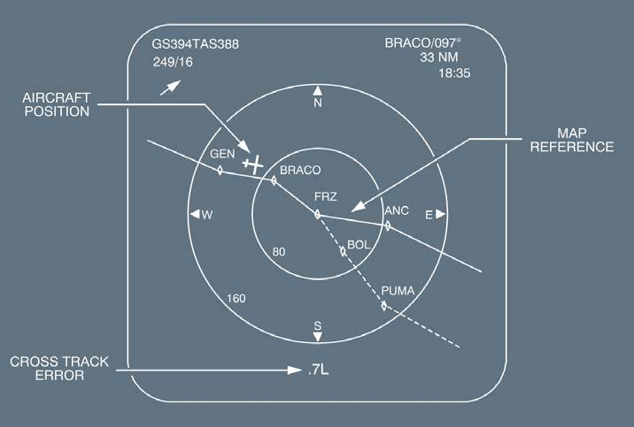
- Path Terminators: These are coded instructions in the navigation database that define how an aircraft transitions between waypoints (e.g., TF - Track to Fix, DF - Direct to Fix, RF - Radius to Fix). Your FMS/GPS handles these, but understanding the concept helps you visualize the flight path.
- Fly-by Waypoint: The aircraft turns before reaching the waypoint to smoothly intercept the next segment.
- Fly-over Waypoint: The aircraft must fly directly over the waypoint before initiating a turn. These are often depicted with a circle around the waypoint symbol on charts.
Flying PBN Procedures: Practical Tips for Student Pilots
Pre-Flight Planning is Paramount:
- NOTAMs: Always check for any PBN-related information, navaid outages (even for underlying conventional navaids if they are part of a contingency), or procedural changes.
- Database Currency: Ensure your aircraft's navigation database is current! An out-of-date database can lead to flying an incorrect or unsafe procedure.
- Aircraft Capability: Confirm your aircraft is approved and equipped for the intended PBN operations (e.g., RNP APCH, LPV capability). Check the AFM.
- RAIM Prediction: If relying on non-SBAS GPS for an RNAV approach (like LNAV), perform a RAIM prediction for your ETA.
Cockpit Setup:
- Carefully select the correct procedure from the database. Double-check waypoints, altitudes, and tracks against your paper or electronic charts.
- Ensure your CDI (Course Deviation Indicator) is set to the correct navigation source (e.g., GPS/FMS).
- Brief the approach, including minima, missed approach procedure, and any threats or special considerations.
Monitoring During the Procedure:
- Actively monitor your CDI and navigation system displays.
- Cross-check your position and track against other available information if possible.
- For RNP procedures, monitor any RNP-related annunciations. Be aware of what your system will tell you if the Actual Navigation Performance (ANP) exceeds the Required Navigation Performance (RNP).
- Adhere to speed and altitude restrictions.
Contingency Procedures:
- What if you lose PBN capability (e.g., GPS signal loss, RAIM unavailability, system failure)? Be prepared to revert to conventional navigation if available and appropriate, or request ATC assistance. Know your aircraft's procedures for loss of navigation.
The Future is PBN
Performance-Based Navigation is no longer a niche capability; it's the global standard. As an EASA IR student pilot, embracing PBN will not only help you pass your skill test but will also equip you with essential skills for a safe and efficient flying career. Keep studying, ask your instructors questions, and practice these procedures diligently.
Welcome to the precise world of Performance-Based Navigation!
Disclaimer: This blog post is for informational purposes only and should not be used as a substitute for official EASA regulations, flight training manuals, or instruction from a certified flight instructor.